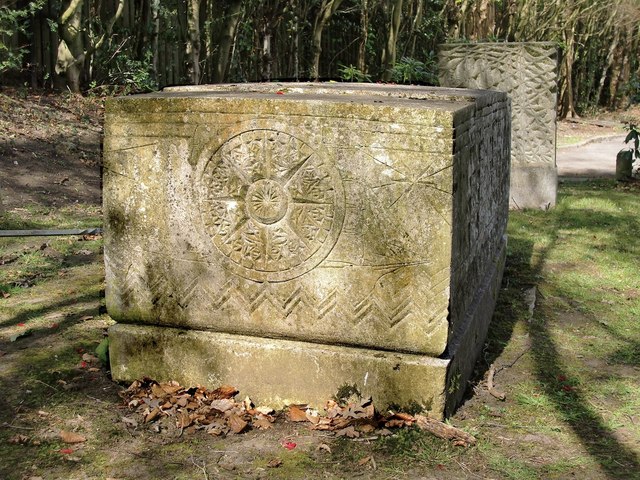
The Ismay plot, Putney Vale Cemetery: the ship's compass
Introduction
The photograph on this page of The Ismay plot, Putney Vale Cemetery: the ship's compass by Stefan Czapski as part of the Geograph project.
The Geograph project started in 2005 with the aim of publishing, organising and preserving representative images for every square kilometre of Great Britain, Ireland and the Isle of Man.
There are currently over 7.5m images from over 14,400 individuals and you can help contribute to the project by visiting https://www.geograph.org.uk

Image: © Stefan Czapski Taken: 15 Apr 2012
This is the tomb-chest seen from the south. All four vertical surfaces of the chest carry nautical imagery in low-relief. The carving on this face represents a ship's compass - though in this vertical orientation the image could also be read as a ship's wheel. The compass device is superimposed on a background showing a (rather sketchy) sailing ship, along with waves and the sun - rather as a child might draw them. The signature 'Gerrard 1939' appears low down on the tomb-chest - which, I believe, means the carving is the work of A.H. Gerrard, who taught at the Slade School of Art. The work is all very free - definitely spirited rather than refined. Whether the sculptor was a personal friend of the Ismays I don't know - but everything seems lovingly done. For more about Bruce Ismay and the family plot, see: Image

