Flush Bracket, Markethill
Introduction
The photograph on this page of Flush Bracket, Markethill by Rossographer as part of the Geograph project.
The Geograph project started in 2005 with the aim of publishing, organising and preserving representative images for every square kilometre of Great Britain, Ireland and the Isle of Man.

There are currently over 7.5m images from over 14,400 individuals and you can help contribute to the project by visiting https://www.geograph.org.uk
Flush Bracket, Markethill
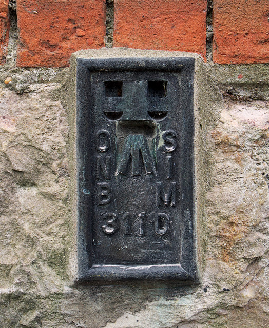
Image: © Rossographer Taken: 12 Apr 2012
Flush bracket bench mark located in the northern face of First Markethill Presbyterian Church Image The number on the bracket is OSNIBM 3110. The mark is 95.95 metres above MSL.
Images are licensed for reuse under creativecommons.org/licenses/by-sa/2.0
Image Location
Latitude
54.297324
Longitude
-6.522577