Longwood valley
Introduction
The photograph on this page of Longwood valley by Humphrey Bolton as part of the Geograph project.
The Geograph project started in 2005 with the aim of publishing, organising and preserving representative images for every square kilometre of Great Britain, Ireland and the Isle of Man.

There are currently over 7.5m images from over 14,400 individuals and you can help contribute to the project by visiting https://www.geograph.org.uk
Longwood valley
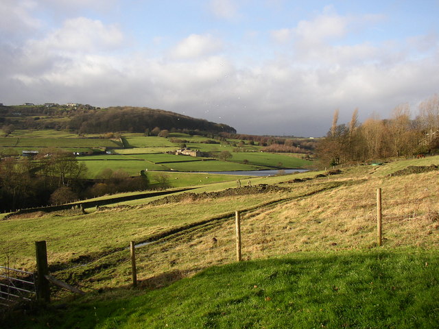
Image: © Humphrey Bolton Taken: 3 Dec 2006
Beyond Dodlee Lane the built-up area ends and there is pleasant pasture. The compensation reservoir controls the flow in the beck, presumably because of abstraction for water supply. The farm beyond is called Leys, and the wood is Pighill Wood. Above this is Nettleton Hill.
Images are licensed for reuse under creativecommons.org/licenses/by-sa/2.0
Image Location
Latitude
53.651201
Longitude
-1.845646