Sandys Street Presbyterian Church and Sandys Street Methodist Church
Introduction
The photograph on this page of Sandys Street Presbyterian Church and Sandys Street Methodist Church by Eric Jones as part of the Geograph project.
The Geograph project started in 2005 with the aim of publishing, organising and preserving representative images for every square kilometre of Great Britain, Ireland and the Isle of Man.

There are currently over 7.5m images from over 14,400 individuals and you can help contribute to the project by visiting https://www.geograph.org.uk
Sandys Street Presbyterian Church and Sandys Street Methodist Church
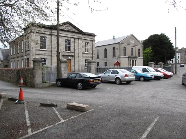
Image: © Eric Jones Taken: 7 Apr 2012
The Presbyterian church, on the left, dates from 1830, whilst the Methodist church was built in 1841. Both were the work of the Newry architect Thomas Duff. http://www.dia.ie/architects/view/1665 http://www.presbyterianireland.org/congregations/newrysandyst.html
Images are licensed for reuse under creativecommons.org/licenses/by-sa/2.0
Image Location
Latitude
54.179289
Longitude
-6.333033