Blue Lias Quarry Westfield Farm
Introduction
The photograph on this page of Blue Lias Quarry Westfield Farm by Nigel Mykura as part of the Geograph project.
The Geograph project started in 2005 with the aim of publishing, organising and preserving representative images for every square kilometre of Great Britain, Ireland and the Isle of Man.

There are currently over 7.5m images from over 14,400 individuals and you can help contribute to the project by visiting https://www.geograph.org.uk
Blue Lias Quarry Westfield Farm
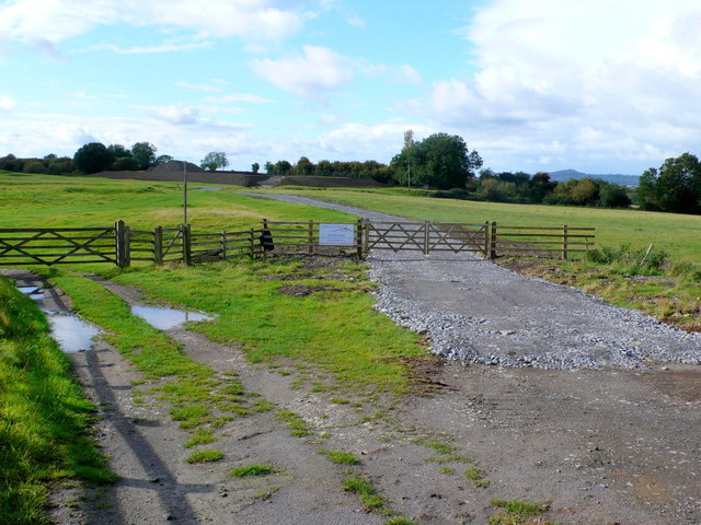
Image: © Nigel Mykura Taken: 18 Sep 2011
This is a view of the new quarry from the public road showing the access road leading to the access gap in the two large earth bunds which screen the site. The blue lias stone has been quarried in this area for many years as an architectural building stone. It is frequently used as stone flagstones in old Somerset houses but the stone at this site is good quality and of thick section which can be used for quoins. The quarry is run by Ham and Doulting Stone. The planning application reference for this quarry is 10/03199/CPO & 11/00493/CPO This is an extract from that planning application:- Access to the extraction field would be via the south-east corner where the ground level is lower than that within the main area proposed for extraction. The construction of two bunds is proposed at the edge of the extraction field where the track enters. A north-south bund would be located on the eastern edge of the permission boundary between the access track and the copse on the eastern boundary. An east-west bund would be located to the west of the access track on the southern edge of the permission boundary between the track and the screening vegetation. These would provide both visual and acoustic screening for the south-eastern corner of the site where there is no existing screening vegetation Only relatively small amounts of stone can be extracted here (2000 tons p.a.) and the extraction is undertaken by a 360 degree digger. The bunds are made of the topsoil off the site and the site will be returned to agricultural use progressively as the extraction proceeds. No processing takes place here the stone being loaded on to lorries to be processed at Ham an Doulting's works 3.5 km to the south. A new field access gate and access road have been constructed and to the left can be seen the old field access gate. In the background distance on the right can be seen Glastonbury Tor.
Images are licensed for reuse under creativecommons.org/licenses/by-sa/2.0
Image Location
Latitude
51.080228
Longitude
-2.6452