Barnoldswick: former 'Foster's Arms'
Introduction
The photograph on this page of Barnoldswick: former 'Foster's Arms' by Dr Neil Clifton as part of the Geograph project.
The Geograph project started in 2005 with the aim of publishing, organising and preserving representative images for every square kilometre of Great Britain, Ireland and the Isle of Man.

There are currently over 7.5m images from over 14,400 individuals and you can help contribute to the project by visiting https://www.geograph.org.uk
Barnoldswick: former 'Foster's Arms'
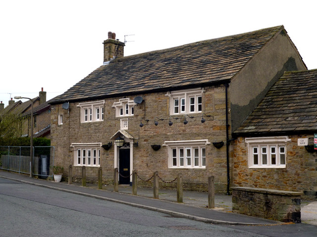
Image: © Dr Neil Clifton Taken: 8 Apr 2012
Sadly, this old pub has closed its doors for the last time. It was one of Barnoldswick's oldest hostelries - two dates on the building show 1699 and 1688.
Images are licensed for reuse under creativecommons.org/licenses/by-sa/2.0
Image Location
Latitude
53.923658
Longitude
-2.194417