Cottages at a crossroads, Chinnor
Introduction
The photograph on this page of Cottages at a crossroads, Chinnor by Richard Dorrell as part of the Geograph project.
The Geograph project started in 2005 with the aim of publishing, organising and preserving representative images for every square kilometre of Great Britain, Ireland and the Isle of Man.

There are currently over 7.5m images from over 14,400 individuals and you can help contribute to the project by visiting https://www.geograph.org.uk
Cottages at a crossroads, Chinnor
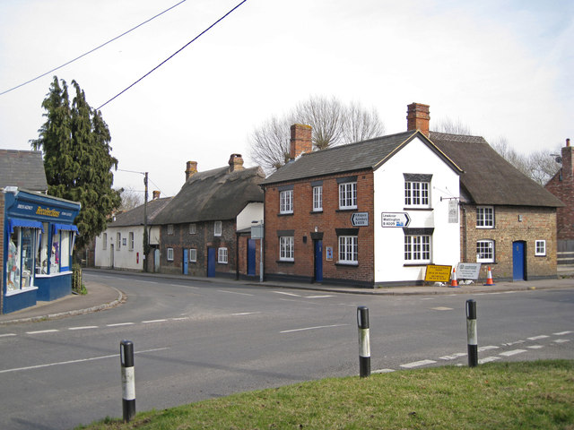
Image: © Richard Dorrell Taken: 14 Mar 2012
This is the scene at the crossroads between Thame Road (on the left), Station Road (on the right) and Lower Road (opposite). Just visible on the right is a teeny bit of Mill Lane. Thame Road/Station Road are part of the B4009. Building materials in common use all around Chinnor include flint and brick, and roofs of thatch.
Images are licensed for reuse under creativecommons.org/licenses/by-sa/2.0
Image Location
Latitude
51.70451
Longitude
-0.91302