The end is nigh for the M58
Introduction
The photograph on this page of The end is nigh for the M58 by Peter Whatley as part of the Geograph project.
The Geograph project started in 2005 with the aim of publishing, organising and preserving representative images for every square kilometre of Great Britain, Ireland and the Isle of Man.

There are currently over 7.5m images from over 14,400 individuals and you can help contribute to the project by visiting https://www.geograph.org.uk
The end is nigh for the M58
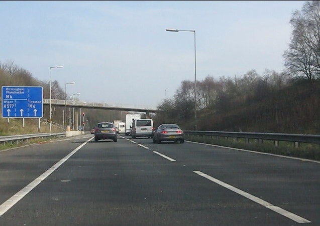
Image: © Peter Whatley Taken: 23 Mar 2012
The motorway approaches the somewhat odd junction at its meeting with the M6, seemingly designed to create maximum traffic flow conflicts. Counter-intuitively, northbound traffic from the M58 takes the right hand lane. Moor Road crosses on the bridge in the distance. For more about this junction, see: http://www.cbrd.co.uk/badjunctions/6-58/.
Images are licensed for reuse under creativecommons.org/licenses/by-sa/2.0
Image Location
Latitude
53.535717
Longitude
-2.702002