Railway cutting exposed
Introduction
The photograph on this page of Railway cutting exposed by Alan Murray-Rust as part of the Geograph project.
The Geograph project started in 2005 with the aim of publishing, organising and preserving representative images for every square kilometre of Great Britain, Ireland and the Isle of Man.

There are currently over 7.5m images from over 14,400 individuals and you can help contribute to the project by visiting https://www.geograph.org.uk
Railway cutting exposed
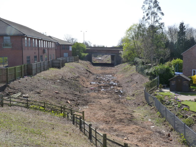
Image: © Alan Murray-Rust Taken: 1 Apr 2012
Vegetation has been removed in preparation for construction of the new tramway, opening up the view of the A52 ring road bridge. Ruddington Lane, from which this view is taken, will be lowered, and the cutting partially filled in to create a level crossing and tram stop.
Images are licensed for reuse under creativecommons.org/licenses/by-sa/2.0
Image Location
Latitude
52.913315
Longitude
-1.158719