The Lodge Burn, Coleraine (5)
Introduction
The photograph on this page of The Lodge Burn, Coleraine (5) by Albert Bridge as part of the Geograph project.
The Geograph project started in 2005 with the aim of publishing, organising and preserving representative images for every square kilometre of Great Britain, Ireland and the Isle of Man.

There are currently over 7.5m images from over 14,400 individuals and you can help contribute to the project by visiting https://www.geograph.org.uk
The Lodge Burn, Coleraine (5)
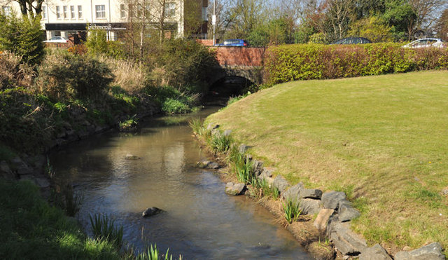
Image: © Albert Bridge Taken: 4 Apr 2012
See Image The view downstream towards the Circular Road (background). Work here is complete but is still in progress at the Railway Road bridge. Continue to Image (June 2012).
Images are licensed for reuse under creativecommons.org/licenses/by-sa/2.0
Image Location
Latitude
55.133065
Longitude
-6.669352