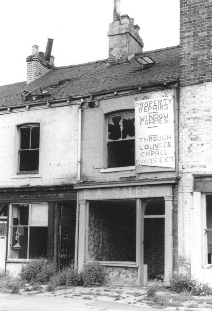
Hessle Road, Kingston upon Hull
Introduction
The photograph on this page of Hessle Road, Kingston upon Hull by Chris Morgan as part of the Geograph project.
The Geograph project started in 2005 with the aim of publishing, organising and preserving representative images for every square kilometre of Great Britain, Ireland and the Isle of Man.
There are currently over 7.5m images from over 14,400 individuals and you can help contribute to the project by visiting https://www.geograph.org.uk

Image: © Chris Morgan Taken: Unknown
Just to the north-east side of the flyover, a block of shops remained, marooned on a cul-de-sac, detached from any passing trade. For a few years they struggled on, gradually falling into ruin, the butchers, the bakers, the greengrocers. A few shops found temporary use for other trades - like a property repairer! But not for long. The amazing thing, looking back, is that in the 1970's nobody bothered to board up the derelict shops. OK, the windows were broken, but they hadn't been set on fire, and they remained like this for years.

