St. Mary de Lode, Gloucester
Introduction
The photograph on this page of St. Mary de Lode, Gloucester by Jonathan Billinger as part of the Geograph project.
The Geograph project started in 2005 with the aim of publishing, organising and preserving representative images for every square kilometre of Great Britain, Ireland and the Isle of Man.

There are currently over 7.5m images from over 14,400 individuals and you can help contribute to the project by visiting https://www.geograph.org.uk
St. Mary de Lode, Gloucester
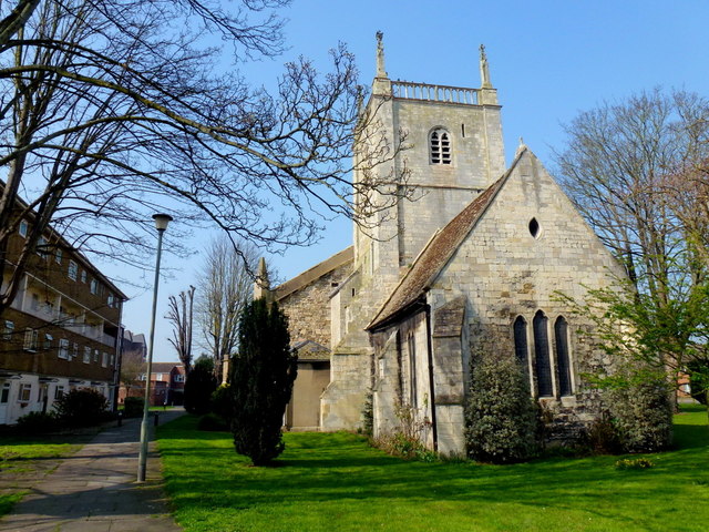
Image: © Jonathan Billinger Taken: 24 Mar 2012
The word Lode is derived from an old English word meaning a water course or ferry. In this case it refers to a ferry that once crossed the river. At the time of building, there was a branch of the river to the west of the church, which no longer exists. The Church is almost definitely the oldest parish church in the city, and according to local legend it was the burial place of Lucius, a king of Britain that established a bishopric in Gloucester in the second century. The church lies to the west of the cathedral and is surrounded by blocks of apartments.
Images are licensed for reuse under creativecommons.org/licenses/by-sa/2.0
Image Location
Latitude
51.868322
Longitude
-2.249322