BHC Marker, Belfast
Introduction
The photograph on this page of BHC Marker, Belfast by Rossographer as part of the Geograph project.
The Geograph project started in 2005 with the aim of publishing, organising and preserving representative images for every square kilometre of Great Britain, Ireland and the Isle of Man.

There are currently over 7.5m images from over 14,400 individuals and you can help contribute to the project by visiting https://www.geograph.org.uk
BHC Marker, Belfast
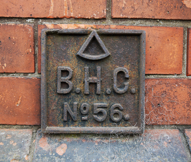
Image: © Rossographer Taken: 2 Apr 2012
Belfast Harbour Commission marker located on the old shipyard wall running along the Sydenham Road in Belfast Image The number on this one is 56. See also http://www.geograph.org.uk/search.php?i=16953880 for related images.
Images are licensed for reuse under creativecommons.org/licenses/by-sa/2.0
Image Location
Latitude
54.603367
Longitude
-5.905467