Leicester - City Centre
Introduction
The photograph on this page of Leicester - City Centre by David Hallam-Jones as part of the Geograph project.
The Geograph project started in 2005 with the aim of publishing, organising and preserving representative images for every square kilometre of Great Britain, Ireland and the Isle of Man.

There are currently over 7.5m images from over 14,400 individuals and you can help contribute to the project by visiting https://www.geograph.org.uk
Leicester - City Centre
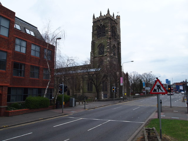
Image: © David Hallam-Jones Taken: 31 Mar 2012
A view of St Margaret's Anglican Church at the side of St Margaret's Way. This is the point at which the A6 from the north meets Leicester's inner ring road (the Burley's Way/Vaughan Way stretch). Between the two most prominient buildings in the picture lies Canning Place. There is however, no vehicular access to or from it now for traffic safety reasons.
Images are licensed for reuse under creativecommons.org/licenses/by-sa/2.0
Image Location
Latitude
52.6405
Longitude
-1.137065