
Nottingham - Basford NG6
Introduction
The photograph on this page of Nottingham - Basford NG6 by David Hallam-Jones as part of the Geograph project.
The Geograph project started in 2005 with the aim of publishing, organising and preserving representative images for every square kilometre of Great Britain, Ireland and the Isle of Man.

There are currently over 7.5m images from over 14,400 individuals and you can help contribute to the project by visiting https://www.geograph.org.uk
Nottingham - Basford NG6
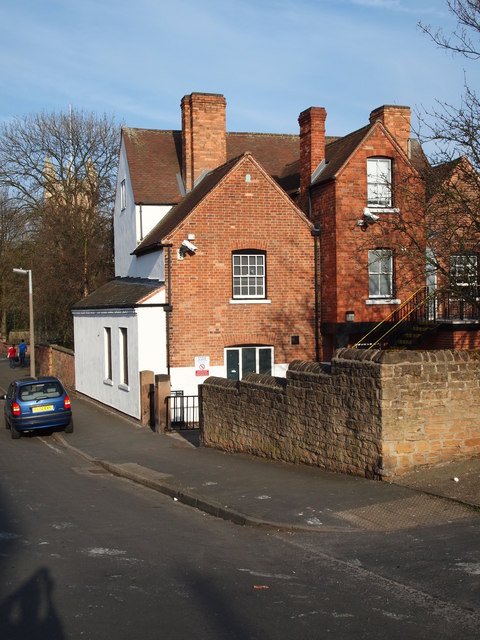
Image: © David Hallam-Jones Taken: 30 Mar 2012
A short section of Bailey Street showing the rear of some of the premises on the "Old Basford Health Centre" site. High up on the gable end wall, 5ft or so above the first floor window is a fire insurance mark (plaque). During the 18th century many insurance companies maintained their own fire brigades, which sought to extinguish fires in those buildings insured by their company. By 1825 fire marks served more as advertisements than as marks identifying paid-up policy holders and some insurance companies had already ceased to issue them.
Images are licensed for reuse under creativecommons.org/licenses/by-sa/2.0
Image Location

Latitude
52.979175
Longitude
-1.179632