Drinking troughs at Loxley
Introduction
The photograph on this page of Drinking troughs at Loxley by Alan Murray-Rust as part of the Geograph project.
The Geograph project started in 2005 with the aim of publishing, organising and preserving representative images for every square kilometre of Great Britain, Ireland and the Isle of Man.

There are currently over 7.5m images from over 14,400 individuals and you can help contribute to the project by visiting https://www.geograph.org.uk
Drinking troughs at Loxley
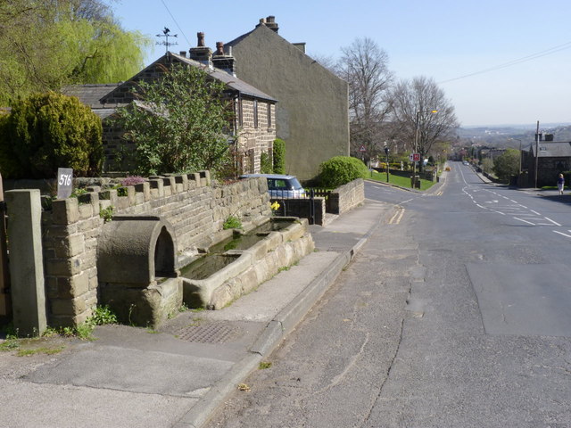
Image: © Alan Murray-Rust Taken: 27 Mar 2012
There were clearly a series of troughs provided along Loxley Road - another survives at Stacey Bank http://www.geograph.org.uk/photo/2872934. The hilly nature of the area would have meant hard work for draught horses, and it was presumably also a drove road for sheep and cattle.
Images are licensed for reuse under creativecommons.org/licenses/by-sa/2.0
Image Location
Latitude
53.404851
Longitude
-1.53939