Tower Street, Belfast
Introduction
The photograph on this page of Tower Street, Belfast by Albert Bridge as part of the Geograph project.
The Geograph project started in 2005 with the aim of publishing, organising and preserving representative images for every square kilometre of Great Britain, Ireland and the Isle of Man.

There are currently over 7.5m images from over 14,400 individuals and you can help contribute to the project by visiting https://www.geograph.org.uk
Tower Street, Belfast
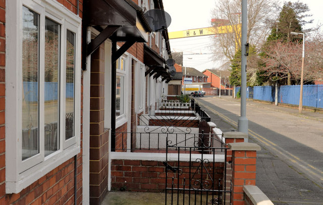
Image: © Albert Bridge Taken: 29 Mar 2012
A late19th century street off the Newtownards Road (background). Much of the eastern side was used for the new Rupert Stanley College of Further Education Image which replaced the one in Templemore Avenue Image Part of the western side remains as built. The part nearest the camera was (to the best of my knowledge) destroyed by the Luftwaffe in WWII. The replacement houses are in a similar style to those in nearby Belvoir Street Image
Images are licensed for reuse under creativecommons.org/licenses/by-sa/2.0
Image Location
Latitude
54.598575
Longitude
-5.903702