Railway at Bangor West
Introduction
The photograph on this page of Railway at Bangor West by Albert Bridge as part of the Geograph project.
The Geograph project started in 2005 with the aim of publishing, organising and preserving representative images for every square kilometre of Great Britain, Ireland and the Isle of Man.

There are currently over 7.5m images from over 14,400 individuals and you can help contribute to the project by visiting https://www.geograph.org.uk
Railway at Bangor West
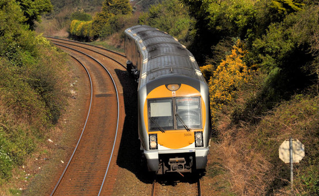
Image: © Albert Bridge Taken: 27 Mar 2012
Set no 3006, rounding the sharp curve on the approach to Bangor West, with the 10.15 Portadown – Bangor.
Images are licensed for reuse under creativecommons.org/licenses/by-sa/2.0
Image Location
Latitude
54.660708
Longitude
-5.693743