Nottingham - NG1
Introduction
The photograph on this page of Nottingham - NG1 by David Hallam-Jones as part of the Geograph project.
The Geograph project started in 2005 with the aim of publishing, organising and preserving representative images for every square kilometre of Great Britain, Ireland and the Isle of Man.

There are currently over 7.5m images from over 14,400 individuals and you can help contribute to the project by visiting https://www.geograph.org.uk
Nottingham - NG1
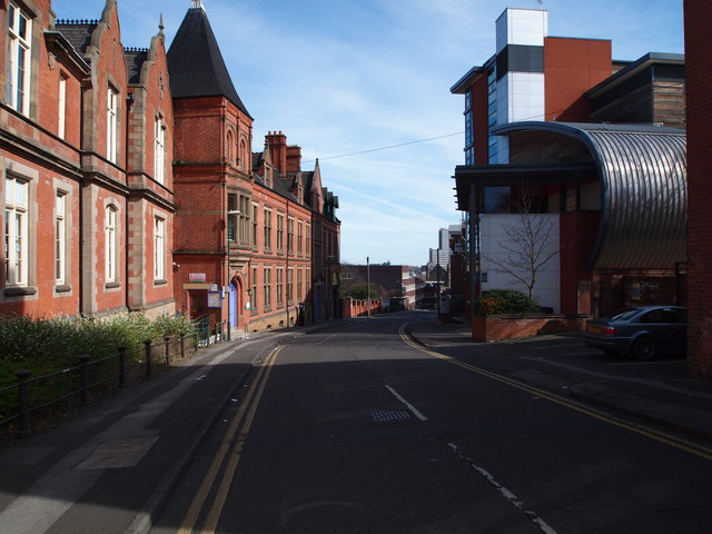
Image: © David Hallam-Jones Taken: 25 Mar 2012
New College Nottingham’s 6th Form College on the right-hand side moved to Chaucer Street in 2001. The £6.3m building with its horizontally positioned ‘tin can roof' was designed by Ellis Williams Architects. The school began life as the Unitarian Day Charity School in the Lace Market area, later changing its name to High Pavement Grammar School. During 1895-1955 the school was situated in Stanley Rd in Forest Fields until it moved to a site on the Bestwood Estate. In 1975 it became High Pavement 6th Form College and in 1999 it was amalgamated into New College Nottingham. The Clarendon building on the left is divided into two sections, one used by Nottingham Trent University and the other by the Nottingham Women's Centre. This extensive building was built as The Midland Institution for the Blind. It was erected in 1853 to "educate fifty inmates and an unlimited number of non-resident blind persons and to instruct them in basket-making and other trades and callings". Additional workshops were added in 1889.
Images are licensed for reuse under creativecommons.org/licenses/by-sa/2.0
Image Location
Latitude
52.956992
Longitude
-1.156979