Margate Cave
Introduction
The photograph on this page of Margate Cave by Jo and Steve Turner as part of the Geograph project.
The Geograph project started in 2005 with the aim of publishing, organising and preserving representative images for every square kilometre of Great Britain, Ireland and the Isle of Man.

There are currently over 7.5m images from over 14,400 individuals and you can help contribute to the project by visiting https://www.geograph.org.uk
Margate Cave
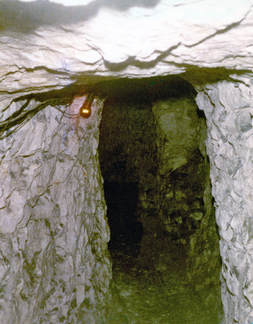
Image: © Jo and Steve Turner Taken: 5 Jun 1979
Rediscovered in 1798, these caves are reputed to be of Saxon origin, consisting of a series of natural passages, which have been artificially enlarged, perhaps for the chalk. They contain some unusual paintings created after the rediscovery. The Margate Cave had to be closed in 2004 because of the instability of the soft chalk. There was subsidence which made the visit unsafe. In 1914 a new entrance was made from the cellar of the vicarage, which is the entrance used today. The vicarage was part of Northumberland House and was destroyed in World War II. The caves have been connected to Vortigern who supposedly gave the area around Margate to the Saxons as a reward for helping him fight the Picts and Scots.
Images are licensed for reuse under creativecommons.org/licenses/by-sa/2.0
Image Location
Latitude
51.390134
Longitude
1.386569