The Lodge Burn, Coleraine (2)
Introduction
The photograph on this page of The Lodge Burn, Coleraine (2) by Albert Bridge as part of the Geograph project.
The Geograph project started in 2005 with the aim of publishing, organising and preserving representative images for every square kilometre of Great Britain, Ireland and the Isle of Man.

There are currently over 7.5m images from over 14,400 individuals and you can help contribute to the project by visiting https://www.geograph.org.uk
The Lodge Burn, Coleraine (2)
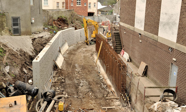
Image: © Albert Bridge Taken: 24 Mar 2012
See Image (January 2012). A similar view, from the Railway Road, where work is continuing on this flood-alleviation scheme. The retaining wall (left) has been built since the previous photograph. Continue to Image – 4 April 2012.
Images are licensed for reuse under creativecommons.org/licenses/by-sa/2.0
Image Location
Latitude
55.132491
Longitude
-6.666079