A rash of signs at Hardy Farm, Chorlton
Introduction
The photograph on this page of A rash of signs at Hardy Farm, Chorlton by Phil Champion as part of the Geograph project.
The Geograph project started in 2005 with the aim of publishing, organising and preserving representative images for every square kilometre of Great Britain, Ireland and the Isle of Man.

There are currently over 7.5m images from over 14,400 individuals and you can help contribute to the project by visiting https://www.geograph.org.uk
A rash of signs at Hardy Farm, Chorlton
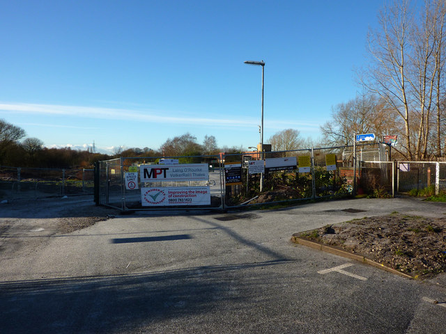
Image: © Phil Champion Taken: 18 Dec 2011
This is the view from the very end of Hardy Lane, at the entrance to Hardy Farm. The extension of the Metrolink tram network towards Manchester Airport will be routed down Hardy Lane and a site compound had already been constructed just beyond the former pavilion building. Most of the signs seen here relate to the construction project. In the late 1960s or early 70s UMIST reclaimed low lying land alongside the river Mersey and created the Hardy Farm Sports Ground. The pavilion can just be seen peeking out above the fencing. However later subsidence caused the sports pitches to be abandoned. The University later sold much of the land to West Didsbury and Chorlton Grounds Ltd who applied for permission to develop the site, creating a number of grass and astroturf pitches, with associated floodlighting etc. This application was withdrawn. In early 2011 Christian organisation Betel of Britain gained planning consent to convert the pavilion to a residential training centre. They have also announced plans for the management of the rest of the Upper Hardy Farm site which, whilst involving restoration of the playing fields, appears to be rather more sensitive and take into account the biological importance of the site and allow for continued informal public access.
Images are licensed for reuse under creativecommons.org/licenses/by-sa/2.0
Image Location
Latitude
53.430401
Longitude
-2.278546