Defensive Position in Newton Blossomville
Introduction
The photograph on this page of Defensive Position in Newton Blossomville by Nigel Stickells as part of the Geograph project.
The Geograph project started in 2005 with the aim of publishing, organising and preserving representative images for every square kilometre of Great Britain, Ireland and the Isle of Man.

There are currently over 7.5m images from over 14,400 individuals and you can help contribute to the project by visiting https://www.geograph.org.uk
Defensive Position in Newton Blossomville
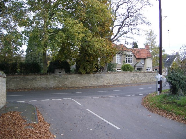
Image: © Nigel Stickells Taken: 14 Nov 2006
Visible above the Rectory wall, and facing up the road (behind camera), is a defensive gun slit with a plaque beneath which states "This loophole was constructed in 1940 for use by members of the home guard in case of invasion by Hitler's Armies - 8th May 1995"
Images are licensed for reuse under creativecommons.org/licenses/by-sa/2.0
Image Location
Latitude
52.153144
Longitude
-0.649403