Smedley Viaduct
Introduction
The photograph on this page of Smedley Viaduct by David Dixon as part of the Geograph project.
The Geograph project started in 2005 with the aim of publishing, organising and preserving representative images for every square kilometre of Great Britain, Ireland and the Isle of Man.

There are currently over 7.5m images from over 14,400 individuals and you can help contribute to the project by visiting https://www.geograph.org.uk
Smedley Viaduct
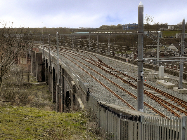
Image: © David Dixon Taken: 19 Mar 2012
A view along the Smedley Viaduct from Collyhurst Road. The 19th century, former railway viaduct has been refurbished in readiness for the opening of the Manchester to Oldham phase of the Metrolink extension. This section, running along the abandoned railway corridor to Central Park in East Manchester was originally planned to open in spring 2011 (http://www.metrolink.co.uk/pdf/future_metrolink/latest_news_publicatios/10-0004_Link3Reprintlowres.pdf ) but that has now been revised to 2012 (http://www.metrolink.co.uk/futuremetrolink/oldham-and-rochdale-line.asp )
Images are licensed for reuse under creativecommons.org/licenses/by-sa/2.0
Image Location
Latitude
53.500357
Longitude
-2.223527