Ashendon church
Introduction
The photograph on this page of Ashendon church by Graham Horn as part of the Geograph project.
The Geograph project started in 2005 with the aim of publishing, organising and preserving representative images for every square kilometre of Great Britain, Ireland and the Isle of Man.

There are currently over 7.5m images from over 14,400 individuals and you can help contribute to the project by visiting https://www.geograph.org.uk
Ashendon church
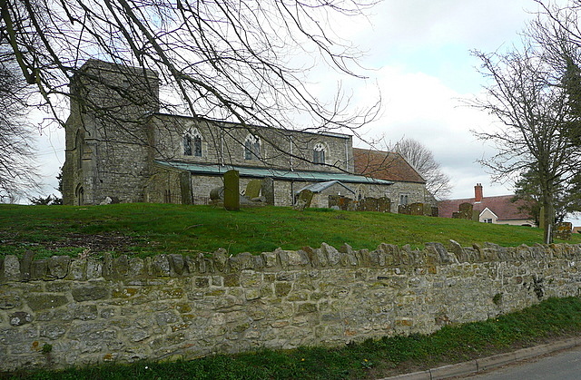
Image: © Graham Horn Taken: 10 Mar 2012
Dedicated to St Mary. The earliest date is probably 12th century, but the nave was extended in the 13th century and heightened in the 15th century, with other 16th century alterations. There is a lot of architectural information here http://www.crsbi.ac.uk/search/county/site/ed-bk-ashen.html
Images are licensed for reuse under creativecommons.org/licenses/by-sa/2.0
Image Location
Latitude
51.822074
Longitude
-0.978386