Turnip Lock gates at Hadley
Introduction
The photograph on this page of Turnip Lock gates at Hadley by Roger Dean as part of the Geograph project.
The Geograph project started in 2005 with the aim of publishing, organising and preserving representative images for every square kilometre of Great Britain, Ireland and the Isle of Man.

There are currently over 7.5m images from over 14,400 individuals and you can help contribute to the project by visiting https://www.geograph.org.uk
Turnip Lock gates at Hadley
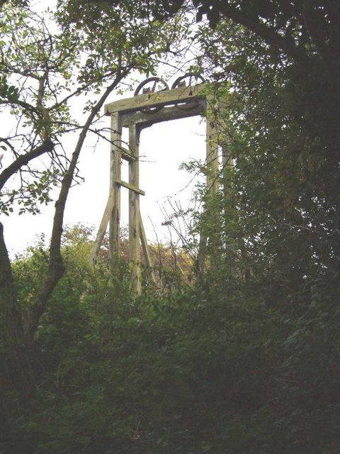
Image: © Roger Dean Taken: 20 Oct 2005
These are the remains of the "turnip lock" gates on the Shrewsbury Canal at Hadley. This lock is the second lock in this area. It is situated approximately 50 yards from the Silkin Way path.
Images are licensed for reuse under creativecommons.org/licenses/by-sa/2.0
Image Location


Leaflet Map data © OpenStreetMap
Latitude
52.71817
Longitude
-2.482575