Send Evangelical Church
Introduction
The photograph on this page of Send Evangelical Church by Robin Webster as part of the Geograph project.
The Geograph project started in 2005 with the aim of publishing, organising and preserving representative images for every square kilometre of Great Britain, Ireland and the Isle of Man.

There are currently over 7.5m images from over 14,400 individuals and you can help contribute to the project by visiting https://www.geograph.org.uk
Send Evangelical Church
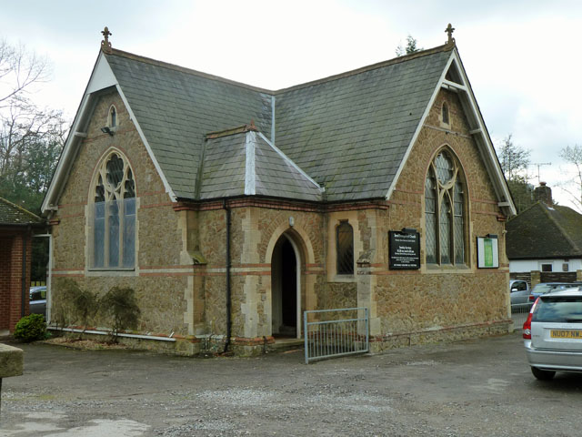
Image: © Robin Webster Taken: 18 Mar 2012
A curious little T-shaped building, with a mirror image porch on the other side as well. The OS map shows what looks like a church hall as the place of worship here, rather than this. Part is just visible on the left - it is certainly a much bigger building.
Images are licensed for reuse under creativecommons.org/licenses/by-sa/2.0
Image Location
Latitude
51.295572
Longitude
-0.541613