Aynscombe Angle
Introduction
The photograph on this page of Aynscombe Angle by Ian Capper as part of the Geograph project.
The Geograph project started in 2005 with the aim of publishing, organising and preserving representative images for every square kilometre of Great Britain, Ireland and the Isle of Man.

There are currently over 7.5m images from over 14,400 individuals and you can help contribute to the project by visiting https://www.geograph.org.uk
Aynscombe Angle
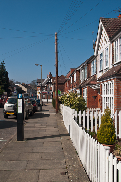
Image: © Ian Capper Taken: 15 Mar 2012
This street is named after Aynscombe House which used to stand on the corner of the road where it met the current High Street. The inclusion of the word "Angle" presumably refers to the shape of the road (it in fact has two sections - the one in this picture with another one meeting it at a right angle half way along). The houses consist of these interesting terraced cottages: these ones are on the east side of the road. The "arts and crafts" style houses were designed by the architect George St Pierre Harris.
Images are licensed for reuse under creativecommons.org/licenses/by-sa/2.0
Image Location


Leaflet Map data © OpenStreetMap
Latitude
51.379581
Longitude
0.103618