Wattsville tunnel
Introduction
The photograph on this page of Wattsville tunnel by Jaggery as part of the Geograph project.
The Geograph project started in 2005 with the aim of publishing, organising and preserving representative images for every square kilometre of Great Britain, Ireland and the Isle of Man.

There are currently over 7.5m images from over 14,400 individuals and you can help contribute to the project by visiting https://www.geograph.org.uk
Wattsville tunnel
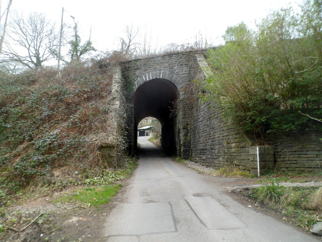
Image: © Jaggery Taken: 16 Mar 2012
A road from Duffryn Terrace and the Sirhowy Valley Country Park passes under Islwyn Road. One map shows "tunnel" though the bridgelike structure is only a few metres long. Headroom is 12' 6" (3.8 metres). Houses in Hafod Tudor Terrace are on the far side. http://www.geograph.org.uk/photo/2852219 to a view from the opposite side.
Images are licensed for reuse under creativecommons.org/licenses/by-sa/2.0
Image Location
Latitude
51.615776
Longitude
-3.151059