Sculpture, information board and bench, Wattsville
Introduction
The photograph on this page of Sculpture, information board and bench, Wattsville by Jaggery as part of the Geograph project.
The Geograph project started in 2005 with the aim of publishing, organising and preserving representative images for every square kilometre of Great Britain, Ireland and the Isle of Man.

There are currently over 7.5m images from over 14,400 individuals and you can help contribute to the project by visiting https://www.geograph.org.uk
Sculpture, information board and bench, Wattsville
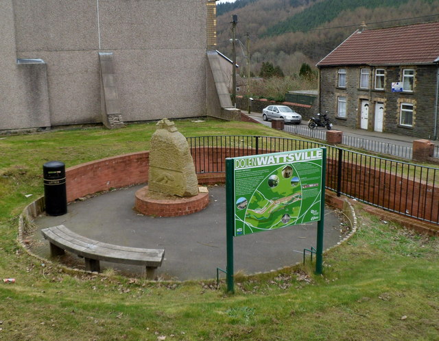
Image: © Jaggery Taken: 16 Mar 2012
Set in a circular area on the north side of Islwyn Road. The sculpture http://www.geograph.org.uk/photo/1910852 depicts a miner and the village of Wattsville. The information board states that the village of Wattsville came into existence in the late 19th century and is named after Edmund Hannay Watts who formed the London and South Wales Coal Company in 1873. The village was built to provide housing for the workers in the numerous collieries in the area including the Risca Mine, which was situated on the eastern edge of the village. This mine was 855 feet deep and was the first pit in South Wales to have electric lighting at the pit head and underground. An explosion at the colliery in 1880 caused 120 deaths, even though the mine was thought to be among the safest in the area. The information board shows a map of the area and gives suggestions of what to see, such as the wildlife and fauna of the Sirhowy Valley Country Park, Full Moon Visitor Centre and the recently-restored Grade II listed Penllwyn Tramroad Bridge. The Welsh language side of the board is in view. The English language side is on the reverse. The bench was a convenient location for lunchtime sandwiches and coffee to be consumed!
Images are licensed for reuse under creativecommons.org/licenses/by-sa/2.0
Image Location
Latitude
51.615819
Longitude
-3.146727