Dried up Priory Pond
Introduction
The photograph on this page of Dried up Priory Pond by Ian Capper as part of the Geograph project.
The Geograph project started in 2005 with the aim of publishing, organising and preserving representative images for every square kilometre of Great Britain, Ireland and the Isle of Man.

There are currently over 7.5m images from over 14,400 individuals and you can help contribute to the project by visiting https://www.geograph.org.uk
Dried up Priory Pond
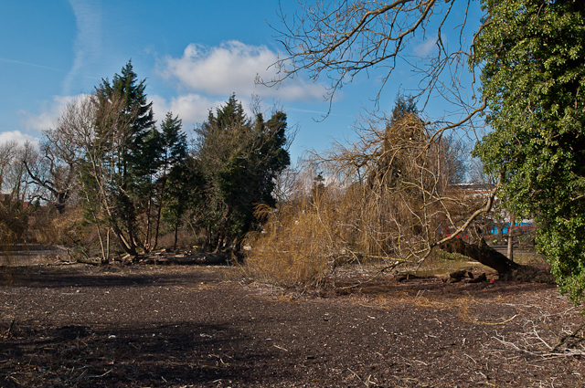
Image: © Ian Capper Taken: 24 Feb 2012
The pond here in Priory Gardens, which forms the source of the River Cray, is normally two to three feet deep. However, in Spring 2012, after a long period of low rainfall, the pond had totally dried up, as seen here.
Images are licensed for reuse under creativecommons.org/licenses/by-sa/2.0
Image Location


Leaflet Map data © OpenStreetMap
Latitude
51.380982
Longitude
0.107232