Nottingham - Mapperley NG3
Introduction
The photograph on this page of Nottingham - Mapperley NG3 by David Hallam-Jones as part of the Geograph project.
The Geograph project started in 2005 with the aim of publishing, organising and preserving representative images for every square kilometre of Great Britain, Ireland and the Isle of Man.

There are currently over 7.5m images from over 14,400 individuals and you can help contribute to the project by visiting https://www.geograph.org.uk
Nottingham - Mapperley NG3
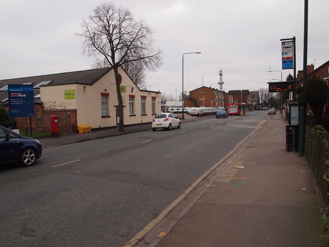
Image: © David Hallam-Jones Taken: 16 Mar 2012
Nottingham City Council's "Mapperley Community Centre" is visible on the left-hand side of Woodborough Road (B684) in the direction of the suburb of Mapperley. This very building was part of the Mapperley Brick Works, at whose entrance it stood. Many millions of its bricks were purchased for use elsewhere in Great Britain, including those used in the construction of St.Pancras Station.
Images are licensed for reuse under creativecommons.org/licenses/by-sa/2.0
Image Location
Latitude
52.980801
Longitude
-1.130153