1930s houses at the end of Hardy Lane, Chorlton
Introduction
The photograph on this page of 1930s houses at the end of Hardy Lane, Chorlton by Phil Champion as part of the Geograph project.
The Geograph project started in 2005 with the aim of publishing, organising and preserving representative images for every square kilometre of Great Britain, Ireland and the Isle of Man.

There are currently over 7.5m images from over 14,400 individuals and you can help contribute to the project by visiting https://www.geograph.org.uk
1930s houses at the end of Hardy Lane, Chorlton
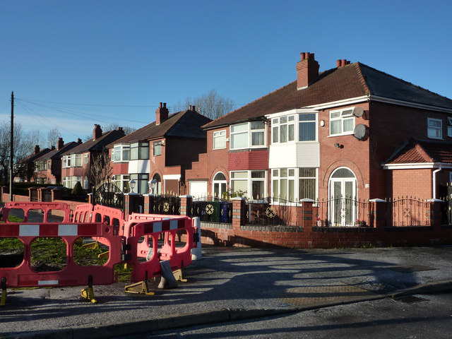
Image: © Phil Champion Taken: 18 Dec 2011
These private houses were built sometime in the late 1930s. They are the very last houses on Hardy Lane. Prior to the 1920 Hardy Lane was a quiet rural lane leading to Hardy Farm and a handful of cottages on the edge of the floodplain of the Mersey. The road was substantially widened when Manchester Corporation built houses in the area in the 1920s/ 30s, with a small area of speculative private development near Hardy Farm. Hardy Lane is unusually wide, although at the Hardy Farm end the carriageway narrows, with a large area of verge in front this last block of houses. The planners had in mind a future extension across the river to Sale in mind, to form a significant arterial road. When the M63 Sale Eastern Bypass was being designed and constructed in the 1960s proposals were in place for a new link road, to be carried across the low lying land at Hardy Farm on a 20ft high embankment. This was never built, although the motorway junction (now M60 J6) was built with this in mind. Although spare from thundering traffic passing their front doors, these houses will in future have the frequent swish of trams, as the Metrolink line to Manchester Airport will run along Hardy Lane - the barriers seen here relate to works to move utilities in advance of the start of construction proper.
Images are licensed for reuse under creativecommons.org/licenses/by-sa/2.0
Image Location
Latitude
53.430673
Longitude
-2.277494