Nottingham - Carrington NG5
Introduction
The photograph on this page of Nottingham - Carrington NG5 by David Hallam-Jones as part of the Geograph project.
The Geograph project started in 2005 with the aim of publishing, organising and preserving representative images for every square kilometre of Great Britain, Ireland and the Isle of Man.

There are currently over 7.5m images from over 14,400 individuals and you can help contribute to the project by visiting https://www.geograph.org.uk
Nottingham - Carrington NG5
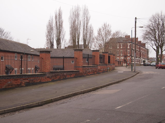
Image: © David Hallam-Jones Taken: 15 Mar 2012
A view of a segment of Watcombe Circus. Behind the railings are severl blocks of retirement apartments. Prior to their existence this was the site of Carrington Lido, a public leisure facility opened in 1937 and finally closed in 1988. Originally the site housed stables for the horses that used to power local trams. However, once these animals were no longer needed following the introduction of electric trams on the Sherwood to Nottingham city centre route, circa 1901, the buildings became surplus to the tram company's requirements.
Images are licensed for reuse under creativecommons.org/licenses/by-sa/2.0
Image Location
Latitude
52.976186
Longitude
-1.150946