E Row houses, Forgeside, Blaenavon
Introduction
The photograph on this page of E Row houses, Forgeside, Blaenavon by Jaggery as part of the Geograph project.
The Geograph project started in 2005 with the aim of publishing, organising and preserving representative images for every square kilometre of Great Britain, Ireland and the Isle of Man.

There are currently over 7.5m images from over 14,400 individuals and you can help contribute to the project by visiting https://www.geograph.org.uk
E Row houses, Forgeside, Blaenavon
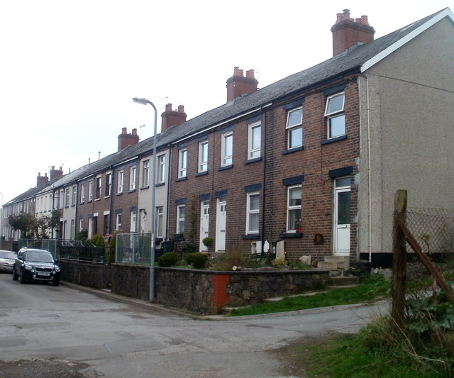
Image: © Jaggery Taken: 15 Apr 2011
The houses were built in 1850s for workers at the nearby ironworks and pits. Anyone unfamiliar with the area would be confused to find houses numbered 1,2,3 etc on both sides of the street. The explanation is that the rows of houses are named, not the street itself. These are houses on E Row, numbered from 17 to 1 in increasing distance from the camera. They face houses out of shot on the left in D Row, numbered 16 to 1. C Row survives, http://www.geograph.org.uk/photo/2850617 but A Row and B Row were demolished in the 1970s.
Images are licensed for reuse under creativecommons.org/licenses/by-sa/2.0
Image Location
Latitude
51.770036
Longitude
-3.098459