Paired Locks at Malkin's Bank, Cheshire
Introduction
The photograph on this page of Paired Locks at Malkin's Bank, Cheshire by Roger D Kidd as part of the Geograph project.
The Geograph project started in 2005 with the aim of publishing, organising and preserving representative images for every square kilometre of Great Britain, Ireland and the Isle of Man.

There are currently over 7.5m images from over 14,400 individuals and you can help contribute to the project by visiting https://www.geograph.org.uk
Paired Locks at Malkin's Bank, Cheshire
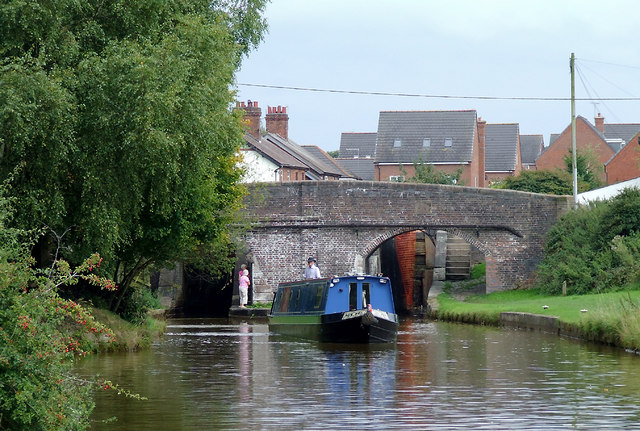
Image: © Roger D Kidd Taken: 31 Aug 2011
This is paired Lock No 63. The right (south) lock is not currently in use. The Locks are Grade II listed as a group with the bridge (No 151). The south side is circa 1776, (James Brindley),and north side (on the left) is from the 1830s, (consultant Thomas Telford). Looking at the bridge brickwork it is difficult to spot the join considering the northern half was built nearly sixty years later then the original. The eight paired locks forming the Wheelock Flight allows a rise in water level of 79ft 6in (24·2 metres). This is the fourth pair up. The flight is also part of the more extended series of twenty-six locks, many also paired, which make up the Cheshire Locks, or "Heartbreak Hill" as the canal climbs towards Kidsgrove and the Harecastle Tunnel. The pairing of nearly all the locks was done circa 1830 to speed the traffic.
Images are licensed for reuse under creativecommons.org/licenses/by-sa/2.0
Image Location
Latitude
53.12916
Longitude
-2.35625