Dove Street South
Introduction
The photograph on this page of Dove Street South by HelenK as part of the Geograph project.
The Geograph project started in 2005 with the aim of publishing, organising and preserving representative images for every square kilometre of Great Britain, Ireland and the Isle of Man.

There are currently over 7.5m images from over 14,400 individuals and you can help contribute to the project by visiting https://www.geograph.org.uk
Dove Street South
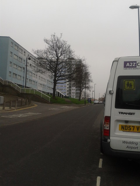
Image: © HelenK Taken: 13 Mar 2012
A two-dimensional map does not do justice to the topography of this part of Bristol. Roads turn into flights of steps, pass above and beneath one another or (like Dove Street) swing round in hairpin bends. This section of Dove Street South is however relatively straight and level, with the flight of steps leading up to the flats giving some idea of the lie of the land.
Images are licensed for reuse under creativecommons.org/licenses/by-sa/2.0
Image Location


Leaflet Map data © OpenStreetMap
Latitude
51.46303
Longitude
-2.591136