St Anne's Well
Introduction
The photograph on this page of St Anne's Well by Neil Owen as part of the Geograph project.
The Geograph project started in 2005 with the aim of publishing, organising and preserving representative images for every square kilometre of Great Britain, Ireland and the Isle of Man.

There are currently over 7.5m images from over 14,400 individuals and you can help contribute to the project by visiting https://www.geograph.org.uk
St Anne's Well
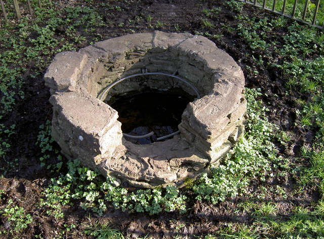
Image: © Neil Owen Taken: 7 Mar 2012
This is all that is now visible of this important pilgrimage site, set in a small wooded valley in south Bristol - see Image Once there was a chapel and a more substantial wellhead in mediaeval times, which was one of the country's most venerated holy places. Many notables worshipped here, including Henry VII; today it is now a suburb of Bristol, having grown and swallowed the parish in the twentieth century. See http://people.bath.ac.uk/liskmj/living-spring/sourcearchive/fs4/fs4cl1.htm for a detailed description of the well and its history. See also Image] for a look to see into the waters.
Images are licensed for reuse under creativecommons.org/licenses/by-sa/2.0
Image Location
Latitude
51.450302
Longitude
-2.545785