South Lodge to Langleys
Introduction
The photograph on this page of South Lodge to Langleys by Tiger as part of the Geograph project.
The Geograph project started in 2005 with the aim of publishing, organising and preserving representative images for every square kilometre of Great Britain, Ireland and the Isle of Man.

There are currently over 7.5m images from over 14,400 individuals and you can help contribute to the project by visiting https://www.geograph.org.uk
South Lodge to Langleys
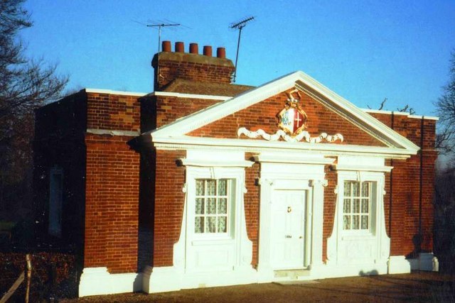
Image: © Tiger Taken: 26 Dec 1978
The lodge at the entrance to the park on the Chelmsford Road was built around 1719 by Samuel Tufnell, the new owner of the property, and his wife Elizabeth Cressener, As Pevsner points out, the pedimented design displaying the Image imitates the main house Image in miniature. Compare with the much simpler Image An anachronistic note, jarring with this early Georgian elegance, is struck by the two aerials on the roof: on the left, Band II (for VHF radio), apparently aligned with the Wrotham transmitter in Kent, and to the right a UHF TV aerial probably looking at Crystal Palace. In a more recent view Image these have been removed and only a discreet flagpole (or perhaps a disguised digital antenna?) rises from the roofline.
Images are licensed for reuse under creativecommons.org/licenses/by-sa/2.0
Image Location
Latitude
51.793367
Longitude
0.461793