Earthwork on the hill above Bracewell
Introduction
The photograph on this page of Earthwork on the hill above Bracewell by Gary Rogers as part of the Geograph project.
The Geograph project started in 2005 with the aim of publishing, organising and preserving representative images for every square kilometre of Great Britain, Ireland and the Isle of Man.

There are currently over 7.5m images from over 14,400 individuals and you can help contribute to the project by visiting https://www.geograph.org.uk
Earthwork on the hill above Bracewell
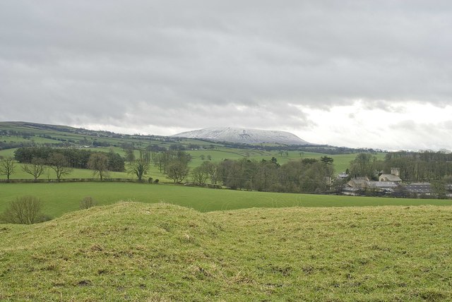
Image: © Gary Rogers Taken: 5 Mar 2011
This is the view Southwest from the earthwork labelled in the top right of the SD8648 gridsquare. The hill is currently given over to sheep grazing and there is little visible structure other than the ridge that can be seen in the left foreground of this picture and runs off down the slope to the south. St Michael's church is visible towards the right of the image and Pendle Hill (with a light dusting of snow from the previous night) is visible in the distance about 8 miles to the south west.
Images are licensed for reuse under creativecommons.org/licenses/by-sa/2.0
Image Location
Latitude
53.934157
Longitude
-2.204214