
Taylors Lane Power Station
Introduction
The photograph on this page of Taylors Lane Power Station by Martin Addison as part of the Geograph project.
The Geograph project started in 2005 with the aim of publishing, organising and preserving representative images for every square kilometre of Great Britain, Ireland and the Isle of Man.

There are currently over 7.5m images from over 14,400 individuals and you can help contribute to the project by visiting https://www.geograph.org.uk
Taylors Lane Power Station
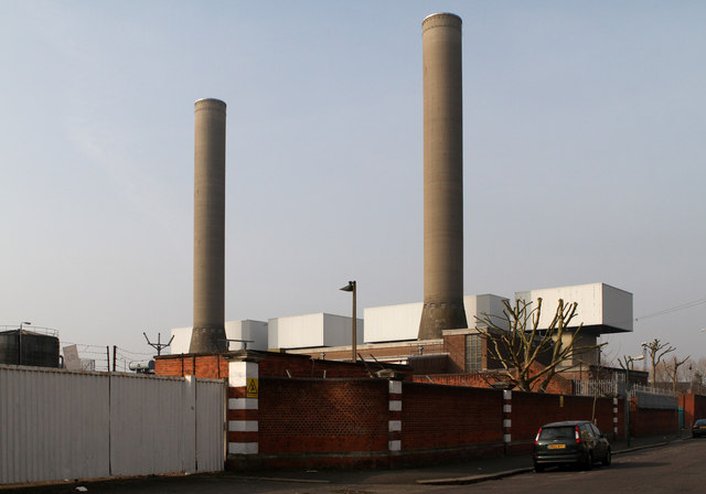
Image: © Martin Addison Taken: 1 Mar 2012
Seen from the junction of Taylors Lane and Gibbons Road. There was a coal fired power station on this site which opened in 1903. Expanded to deliver 28.6MW in 1937, it was closed in 1972 and demolished. The current power station is powered by gas-oil and opened in 1979. It is controlled remotely from Grain Power Station. The oil for the power generation was delivered by rail but the sidings are now disconnected from the rail network so presumably oil deliveries now happen by road. The station has the capacity to deliver 132MW of power.
Images are licensed for reuse under creativecommons.org/licenses/by-sa/2.0
Image Location

Latitude
51.545996
Longitude
-0.257441