Taylors Lane
Introduction
The photograph on this page of Taylors Lane by Martin Addison as part of the Geograph project.
The Geograph project started in 2005 with the aim of publishing, organising and preserving representative images for every square kilometre of Great Britain, Ireland and the Isle of Man.

There are currently over 7.5m images from over 14,400 individuals and you can help contribute to the project by visiting https://www.geograph.org.uk
Taylors Lane
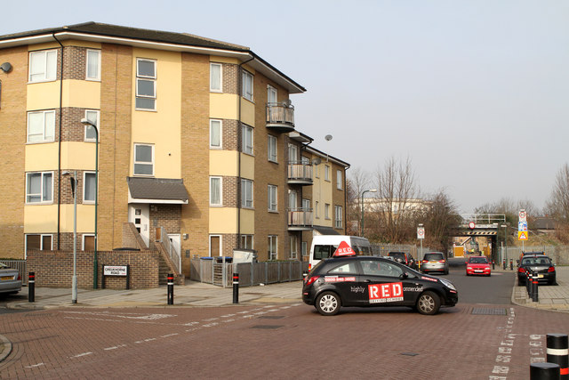
Image: © Martin Addison Taken: 1 Mar 2012
There have been some changes in road names since the area was redeveloped in the early 1970's. Taylors Lane used to connect with Church Road but now the section where I am standing is called Hawkins Road and only the section diving under the bridge retains its original name. On the left Creukhorne Road whilst on the right is Tynsdale Road. The distant bridge carries the Midland railway line between Acton Wells Junction and Cricklewood. The RED driving instructor is executing an circular turn in the junction to avoid doing a three point turn.
Images are licensed for reuse under creativecommons.org/licenses/by-sa/2.0
Image Location
Latitude
51.546043
Longitude
-0.254555