Planning application
Introduction
The photograph on this page of Planning application by Hugh Venables as part of the Geograph project.
The Geograph project started in 2005 with the aim of publishing, organising and preserving representative images for every square kilometre of Great Britain, Ireland and the Isle of Man.

There are currently over 7.5m images from over 14,400 individuals and you can help contribute to the project by visiting https://www.geograph.org.uk
Planning application
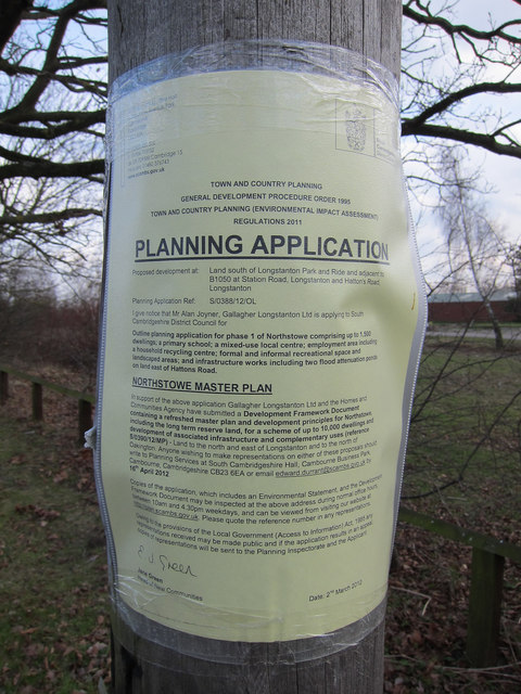
Image: © Hugh Venables Taken: 3 Mar 2012
Normally these are for minor alterations to nearby buildings. This one is for a whole new town, Northstowe.
Images are licensed for reuse under creativecommons.org/licenses/by-sa/2.0
Image Location
Latitude
52.287176
Longitude
0.046116