Church hall, Bovey Tracey
Introduction
The photograph on this page of Church hall, Bovey Tracey by Derek Harper as part of the Geograph project.
The Geograph project started in 2005 with the aim of publishing, organising and preserving representative images for every square kilometre of Great Britain, Ireland and the Isle of Man.

There are currently over 7.5m images from over 14,400 individuals and you can help contribute to the project by visiting https://www.geograph.org.uk
Church hall, Bovey Tracey
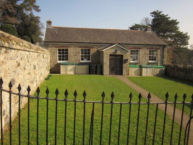
Image: © Derek Harper Taken: 29 Feb 2012
The C19 hall, the former Sunday School, is described at http://www.britishlistedbuildings.co.uk/en-84494-church-hall-amp-garden-railings-about-17- ; the building has been re-slated since the listing was written. Alas, some of the diamond heads are missing from the railings, which are part of the listing. This is from the church steps.
Images are licensed for reuse under creativecommons.org/licenses/by-sa/2.0
Image Location
Latitude
50.595
Longitude
-3.667395