
Gigantic demolition
Introduction
The photograph on this page of Gigantic demolition by James Allan as part of the Geograph project.
The Geograph project started in 2005 with the aim of publishing, organising and preserving representative images for every square kilometre of Great Britain, Ireland and the Isle of Man.

There are currently over 7.5m images from over 14,400 individuals and you can help contribute to the project by visiting https://www.geograph.org.uk
Gigantic demolition
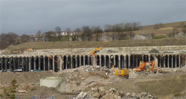
Image: © James Allan Taken: 20 Feb 2012
This is the Castlekey (aka Churchill) storage bunker for naval ships' heavy oil fuel. It was built during WW1 then extended, reinforced and buried during WW2. It has now been under demolition since 2008 and looks like taking a lot longer before the job is completed, despite the use of explosives, compressed air and heavy earth-moving equipment. Not surprising; its outer walls were 8.0 metres thick and it had a 7.5 metre thick reinforced concrete roof supported by over 2,500 columns, each 1.2 metres in diameter. It covers an area of 9.5 acres.
Images are licensed for reuse under creativecommons.org/licenses/by-sa/2.0
Image Location

Latitude
56.024553
Longitude
-3.424864