William Henry Street, Brighouse
Introduction
The photograph on this page of William Henry Street, Brighouse by Humphrey Bolton as part of the Geograph project.
The Geograph project started in 2005 with the aim of publishing, organising and preserving representative images for every square kilometre of Great Britain, Ireland and the Isle of Man.

There are currently over 7.5m images from over 14,400 individuals and you can help contribute to the project by visiting https://www.geograph.org.uk
William Henry Street, Brighouse
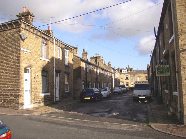
Image: © Humphrey Bolton Taken: 21 Nov 2006
Although part of the late 19C street layout, this street has in it a row of 18C cottages, identified by their lower roof-line. They are Grade II listed, and have the stone doorway surrounds and flat-faced mullioned windows typical of the period in this area. For some reason the street has not been 'made-up' and surfaced with tarmac.
Images are licensed for reuse under creativecommons.org/licenses/by-sa/2.0
Image Location
Latitude
53.70684
Longitude
-1.787877