No3 Stewart's Place, Holywood
Introduction
The photograph on this page of No3 Stewart's Place, Holywood by Albert Bridge as part of the Geograph project.
The Geograph project started in 2005 with the aim of publishing, organising and preserving representative images for every square kilometre of Great Britain, Ireland and the Isle of Man.

There are currently over 7.5m images from over 14,400 individuals and you can help contribute to the project by visiting https://www.geograph.org.uk
No3 Stewart's Place, Holywood
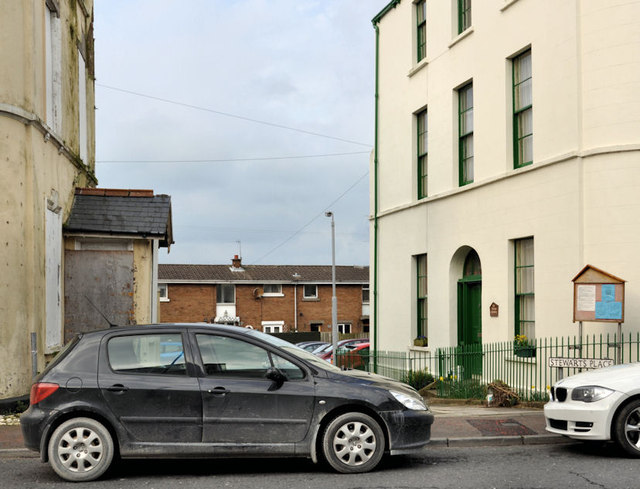
Image: © Albert Bridge Taken: 2 Mar 2012
A former house, built circa 1840 and restored in 1992/3. The derelict Maryville House (1 Stewart’s Place) Image is on the left. The Google map correctly shows Stewart’s Place to the west. Although not shown as such, this is also Stewart’s Place – see the name sign at the car bonnet (right).
Images are licensed for reuse under creativecommons.org/licenses/by-sa/2.0
Image Location
Latitude
54.642875
Longitude
-5.832482