Allet Methodist Church
Introduction
The photograph on this page of Allet Methodist Church by Tony Atkin as part of the Geograph project.
The Geograph project started in 2005 with the aim of publishing, organising and preserving representative images for every square kilometre of Great Britain, Ireland and the Isle of Man.

There are currently over 7.5m images from over 14,400 individuals and you can help contribute to the project by visiting https://www.geograph.org.uk
Allet Methodist Church
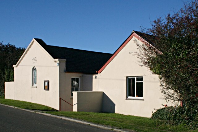
Image: © Tony Atkin Taken: 4 Nov 2006
According to the inscription above the windows the church, which is the furthest building, was built in 1866 and the Sunday School, the building on the right, in 1961.
Images are licensed for reuse under creativecommons.org/licenses/by-sa/2.0
Image Location
Latitude
50.294998
Longitude
-5.102863