Cumbernauld Town Centre
Introduction
The photograph on this page of Cumbernauld Town Centre by Robert Struthers as part of the Geograph project.
The Geograph project started in 2005 with the aim of publishing, organising and preserving representative images for every square kilometre of Great Britain, Ireland and the Isle of Man.

There are currently over 7.5m images from over 14,400 individuals and you can help contribute to the project by visiting https://www.geograph.org.uk
Cumbernauld Town Centre
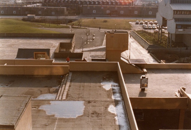
Image: © Robert Struthers Taken: Unknown
Taken in 1981, most of what you can see in the foreground has been demolished and redeveloped. The building on the right is Cumbernauld College, still there to this day. North Carbrain Road is at the top of the picture.
Images are licensed for reuse under creativecommons.org/licenses/by-sa/2.0
Image Location
Latitude
55.945582
Longitude
-3.988203