Former Council Offices, Bamber Bridge
Introduction
The photograph on this page of Former Council Offices, Bamber Bridge by David Dixon as part of the Geograph project.
The Geograph project started in 2005 with the aim of publishing, organising and preserving representative images for every square kilometre of Great Britain, Ireland and the Isle of Man.

There are currently over 7.5m images from over 14,400 individuals and you can help contribute to the project by visiting https://www.geograph.org.uk
Former Council Offices, Bamber Bridge
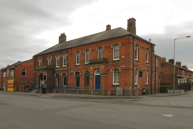
Image: © David Dixon Taken: 25 Feb 2012
The former offices of Walton Le Dale Local Board at the corner of Station Road and Brownedge Lane. The building is in two halves. The original part of the building, constructed in 1880, is nearest to the corner, whilst the later extension (in darker coloured bricks) is to the left. See Image] and Image]
Images are licensed for reuse under creativecommons.org/licenses/by-sa/2.0
Image Location
Latitude
53.731171
Longitude
-2.662207